|
Monday, November 22, 2010
Progress Notes
A couple weeks ago I took a tour of the old Joshua R. Wells farm which is about five miles east of Tuscumbia on Highway 17. I was invited for the tour by Roy Sone of Jefferson City, one of J.R. Wells' grandchildren (photo 01).
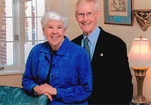
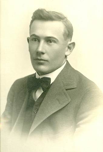
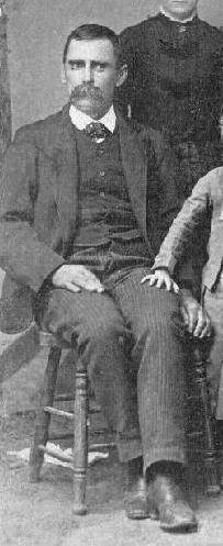
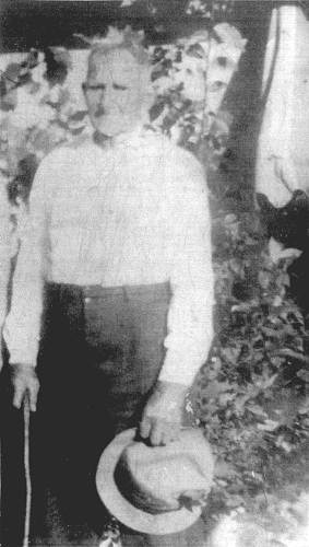
01 Joyce and Roy Sone Although J.R. had moved his family from Tuscumbia to Jefferson City before Roy was born in 1933, the farm was still being managed by the family. When Roy was a boy the person in charge of the farm was Ralph Wells of Tuscumbia, son of J.R. Wells (photo 02).
02 Ralph Wells I had written a long history of the Wells farm in 2008. However, I had not written much about the farm itself. The tour with Roy of the farm gave me quite a lot of interesting information I thought would be of interest to readers, especially if the history of the family presented at the website indicated above has been read beforehand.
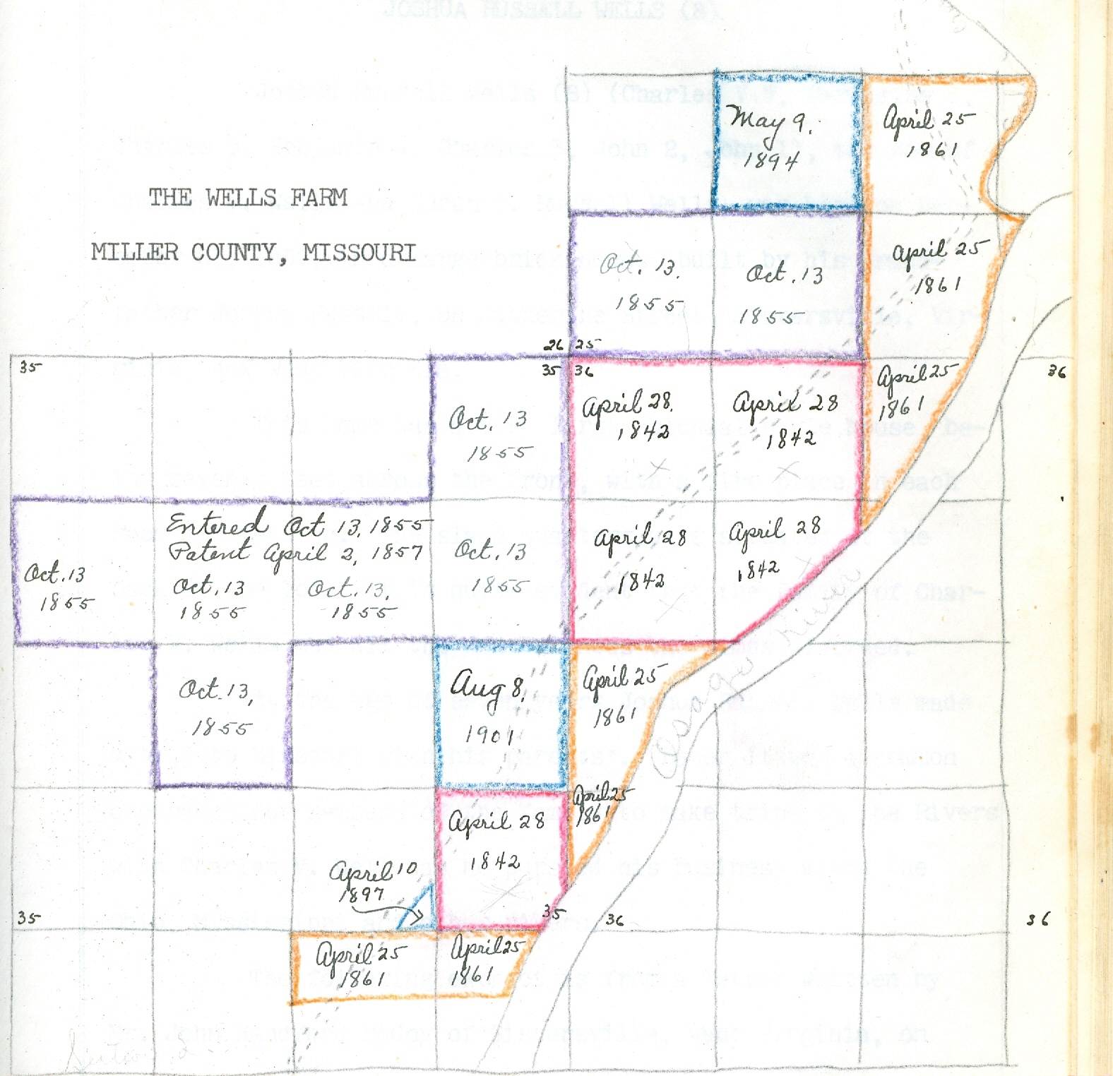
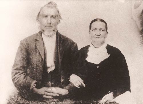
First, I think a short history of the farm is interesting. The farm was acquired in partials over a period of time in the pre Civil War era by Charles V. Wells, father of Joshua Wells (photo 03).
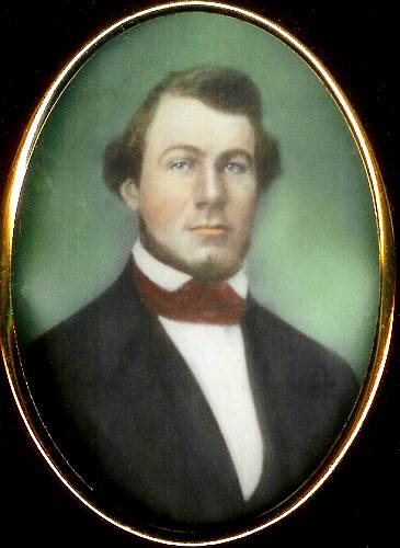
03 Charles V. Wells Charles was a member of the very distinguished Wells family of West Virginia (although pre Civil War, West Virginia was still part of Virginia). He had a large and successful business there of shipping freight, especially cotton, by steam ship up and down the Ohio River. The following is a summary taken from the website cited above of how Charles came to purchase land in Missouri here in Miller County, so far from his home in Virginia (now West Virginia):
On March 30, 1842 Elizabeth and Charlotte Wells gave their brother, Charles Wells, Power of Attorney to handle or dispose of property inherited by them from the Estate of James Miller, their mother, Charlotte (Miller) Wells, having died intestate. Charlotte (Miller) Wells was a daughter of James Miller and Rebecca (Wells) Miller.
The purchase of land was the usual custom of investing money at that time. So, it would seem that it was with this inheritance. On April 28, 1842 Charles Wells purchased land site unseen in Miller County, Missouri, as shown from a Warranty Deed from Andrew McCastland and Mary McCastland, his wife, to Charles V. Wells of Tyler County, Virginia.
Later, Charles came to Missouri with Nicholas Wells, an uncle, of Tyler County, Virginia, who also purchased land along the Osage River in Miller County, Missouri. According to a Tax Receipt among his papers, Charles paid taxes in 1843 in the amount of $3.12 on the 185.06 acres purchased in April, 1842.
The next tract of land acquired in Miller County, Mo. by Charles, was on October 13, 1855, when he entered 320 acres, adjoining the land purchased in April, 1842. This tract was patented April 2, 1857.
On April 25, l861, he purchased at Sheriff's Sale in Partition 144.92 acres in Miller County, Mo. This land also joined the other plots.
Tax receipts for 1876 show taxes paid on 644 acres in Miller County, Missouri.
Here is a diagram created by one of the Wells’ family members demonstrating the individual parcels of land bought by Charles Wells as listed above as well as the dates of purchase (photo 04):
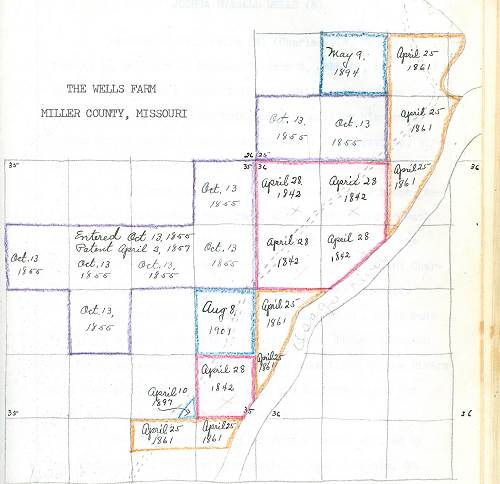
04 Wells Farm Dates of Purchase
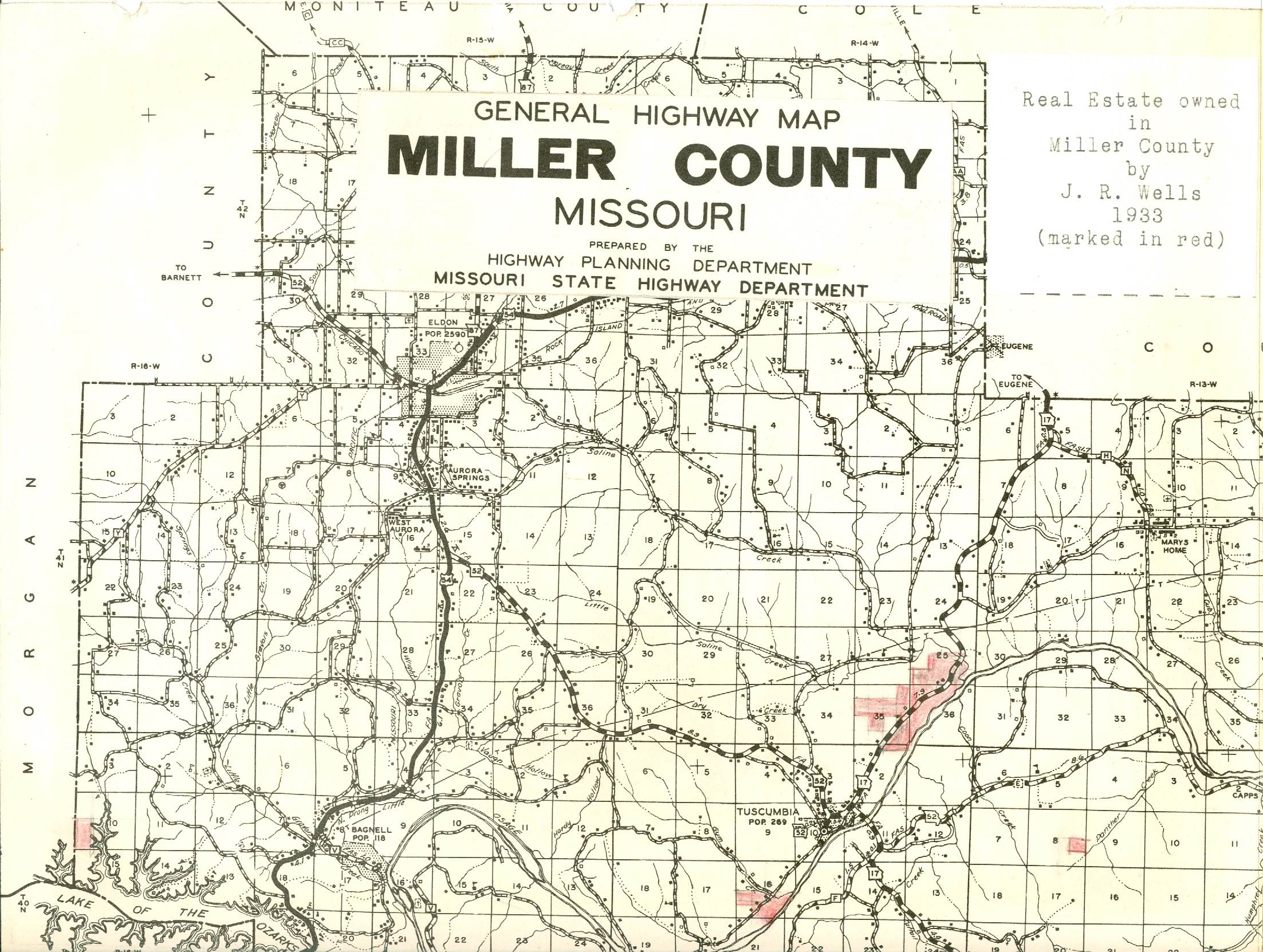
Click image for larger viewAnd here is a portion of the Miller County plat map of 1933 showing the main farm as well as three other parcels of land owned by the Wells family in Miller County at that time (photo 05):
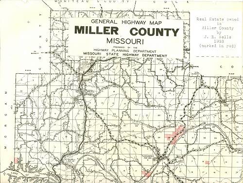
05 Wells Real Estate - 1933
Click image for larger viewThe following is a short summary extracted from the above cited website of the adult life of Charles Wells, father of J.R. Wells, who later became the sole owner of the Wells land acquisitions:
In the pre Civil War years, Charles Wells was very successful running steamers up and down the Ohio and Mississippi rivers carrying freight of all kinds including cotton. At various times he owned up to five or six steam boats. But when the Civil War began President Lincoln ordered a blockade on the Mississippi to isolate New Orleans. Undeterred, Wells and other steamboat owners were able most of the time to run the blockades due to the inferior quality of the Union Army's gun boats which could not intercept them with regularity. However, as time went along, the North's gun boats improved in quality as did the skill of their captains and the Southern steamers began to be captured and destroyed.
At the close of the Civil War Charles Wells and Company owned a large number of bales of cotton costing $61,717.90 which was stored in a warehouse. But Wells could not sell the cotton since he had not taken the "Amnesty Oath" and was still considered a "Rebel." Even though he spent almost a year engaging attorneys and other consultants to take possession of the cotton, all efforts failed. Thus, in 1866 he found himself without his steamboats which had been captured or destroyed, and without any of his stored merchandise being returned to him. Depressed and despondent he decided to leave his family with his father in law, Joshua Russell, and return to his Miller County farm to try to regain his financial losses.
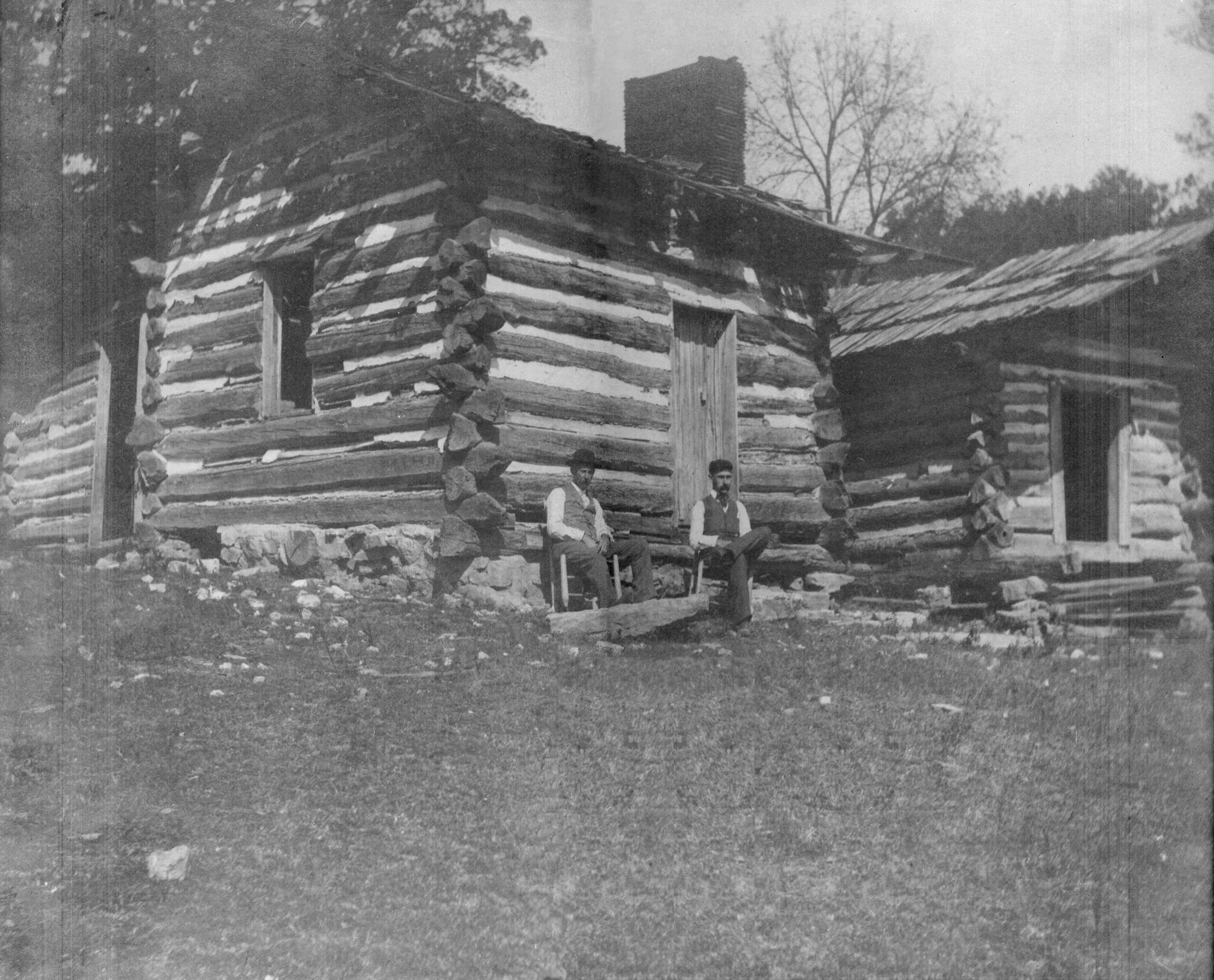
He brought with him books, papers, a tool chest, tools, drapes, which had been used on the steamer Planter, a spyglass and several other articles he had salvaged from his boating days, to make his home in a large log cabin in a wooded section of the farm (photo 06).

06 Charles and brother Will Wells at Original Cabin
Click image for larger viewHe had spent his boyhood on a farm in the Ohio Valley in Virginia. The knowledge obtained there and his determination was all he had to commence a new life as a farmer in Missouri.
His wife Susan and their four children continued to make their home with her father and mother in Sistersville, West Virginia.
The first task Charles had after settling on the farm was to clear more land and sell the timber. On December 28, 1874, he sold timber to M. S. Carter of Osage City, Missouri. The contract stated: "... the said M.S. Carter agrees to pay Four Dollars per 1000 feet for all the Saw Timber in the above Boundary to be measured on the bank of the river bank of the River at C. V. Wells Landing and pay as soon as delivered in raft at Osage City, to be run as soon as possible as the water will admit."
Wells was forced to file a suit to collect for the timber. Judgment was awarded in his favor in the sum of $309.84, on December 13, 1876.
Charles had freighted many bushels of potatoes while in the steamboat business. Therefore, it was only natural that when he was looking for a cash business and one that he knew how to market, he would raise potatoes. Then too, he had a boat landing for a convenient loading place. He was known in the neighborhood as "Potato Charley." A survey made by H. S. Burlingame, Deputy Surveyor of Miller County, Missouri, of the potato field showed 5.18 acres. The date is not given on report of the survey.
When making his three mile trips to Tuscumbia he often walked, taking a steer hitched to a cart to haul his wares to and from the village.
He raised wheat, corn, hay, etc. on the farm. In April, 1879 he rented forty-two acres of ground for corn by contract: fourteen acres to David Hawken (photo 07), sixteen acres to James Simpson and twelve acres to Benjamin F. Lawson (photo 08).
07 David Hawken (b. 22 Jan 1812 - d. 1 May 1891) and 2nd Wife - Name Unknown
08 Benjamin F. Lawson The new friends in Missouri knew little about Charles V. Wells, excepting that he had been a steamboat man. He was a member of the Odd Fellows Lodge of Tuscumbia. Wells made provision for a bountiful supply of food for the winter as shown by the supply on hand at the time of his death in 1880. The circumstances as to the cause of his death are not clearly known.
William Hauenstein of Tuscumbia, Missouri, a very good friend of C. V. Wells wrote the following letter to Mrs. C. V. Wells at the time of the death of her husband:
Tuscumbia, Mo.
January 22, 1880
Mrs. Wells
Dear Madam,
I here with inform you of the death of your husband, Chas. V. Wells. His spirit took its flight last night 20 minutes before 11 o'clock at his Farm.
With easy mind he past away in a pleasant sleep to awaken no more.
His sickness was Pneumonia, the burying will take place here tomorrow afternoon. As a friend I have done all in my power through his sickness and his Farm and stock shall have my attention until in the hands of an Administrator. I will write to you in a few days in what way the personal property will be disposed of.
Sincerely,
William Hauenstein (photo 09)
09 William H. Hauenstein Jr.
|
Mr. Lewis Hawken (photo 09a) and Mr. Al June were with Wells at the time of his death. He was buried in the Tuscumbia Cemetery, at Tuscumbia, Missouri.
09a Lewis Hawken Mr. Hauenstein was appointed administrator of the estate.
Charles V. Wells died intestate, and the sale of his personal property was held on February 6th, 1880, at the farm. It is interesting to note the amounts of food listed as sold at the sale of February 6th:
Bacon, 2 boxes onions, 3 boxes of beans, 2 barrels of salt, keg of molasses, lard, 1 barrel meal, ½ barrel of kraut, 1 box pop corn, and l24 bushels of potatoes, also barrel of soft soap.
A list of his live stock shows: Chickens, ducks, hogs, yoke of oxen, yoke of steers, a pair of yearling steers, cows, heifers, bull calves, and sheep. No horses listed.
Some of the items sold at the sale are as follows:
Harrow, iron maul, 4 live oak mauls, crow bar, plows, ox bows, ox yoke, scythes and corn knives, grind stone, shovels, spade, hoes, rakes, trough axe, mattock, pick, hay fork, manure fork, saws, single tree, tool chest, brace and bits, files, chisels, planes, hammers, augers, square, wrenches, log chains, etc.
The further story of the Wells farm under the management of Charles’ son, Joshua R. Wells, which is very interesting and detailed, can be read at the above listed website. For the rest of this week’s Progress Notes, I want to describe some of the interesting features of the farm which were not included in the Wells history detailed in the Progress Notes of April 28, 2008.
I met Roy at one of the accesses to the Wells farm now owned by the Missouri State Conservation Department located on Highway 17 a few miles east of Tuscumbia. Roy had brought along with him his orange hunter’s vest and cap because being this close to deer season he wanted to be quite visible in case any early pre opening day poachers were out with their high powered rifles (he ought to know since he managed and lived on the farm in the late 1960’s) (photo 10).
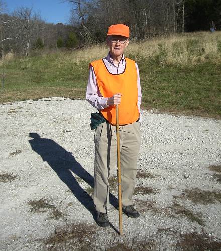
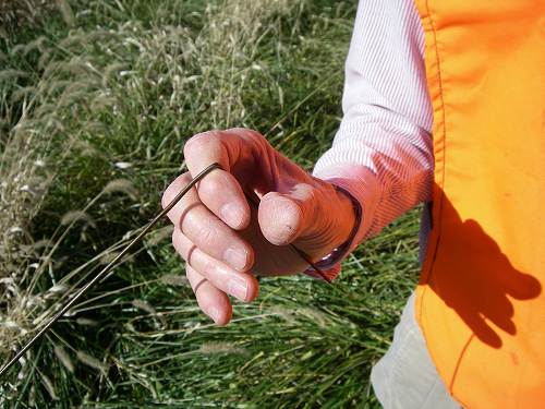
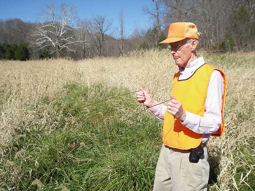
10 Roy Sone You will notice that Roy’s walking stick has two wire horizontal projections below his hands near the top end. Curious, I asked Roy what those wire projections were. He told me that they were his metal detector used for seeking any underground metal objects. Especially they were useful, he said, for the detection of cables or pipes before digging a trench or hole. Here is a collage of photos in which Roy demonstrates the use of this device (photos 11, 12 and 13).
11 Roy demonstrating correct position of Detector in Hand
12 Roy with Metal Detector searching for Underground Metal
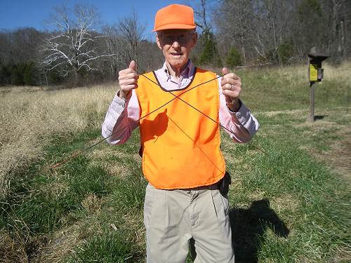
13 Roy with Metal Detector positioned over Underground Metal Roy said the way the wires were held is important as he demonstrates in the photos. When metal is found the wires cross as is demonstrated in the last photo.
I asked Roy if this device was similar to a “water witch” except being metal instead of wood. He told me it wasn’t “worth a durn” for water detection, only metal. He said he always carried it on expeditions in the hope of finding interesting artifacts or even old coins. He then demonstrated it to me and sure enough, quite soon the ends of the wires bent down to the ground quite strongly as shown in photo 13 which Roy said indicated buried metal of some kind!
The first thing Roy told me about the farm was that right at the Conservation access where we parked the car once was located a log cabin where his grandmother, Lucy Lawson, daughter of Ben Lawson, lived. Ben was a tenant farmer for J.R. Wells, who being single at the time, began courting and eventually married Ben’s daughter, Lucy Lawson. Here is a photo of Ben and his family (photo 14):
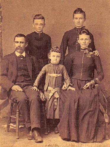
14 Benjamin F. Lawson and Arena Ellen Tarbutton
Children: Emma, Lena and Lucy You can read more of the Lawson family history at this past Progress Notes.
Roy said the old cabin was torn down by the Conservation Commission after its acquisition of the farm.
We then took the old road up the hill to the north which at one time was the old county road leading to Tuscumbia before the Saline Creek bridge was built. One thing I can tell you is that one doesn’t realize just how high these hills are along the Osage River valley because the slant is such that you can’t see the tops of the hills from Highway 17 as you pass by. It was about this time I came to realize just how good a shape Roy is in at 77 years of age as he steadily led the way. We finally reached the top of the hill and followed the old county road for a ways (photo 15).
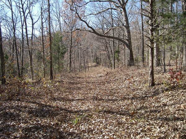
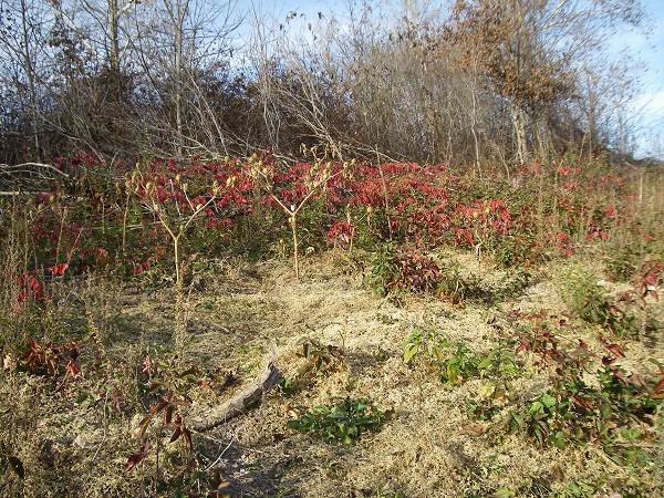
15 Ridge Road Deciduous Holly trees displayed their red leaves (photos 16 and 17).
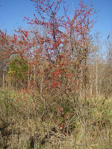
16 Deciduous Holly Tree

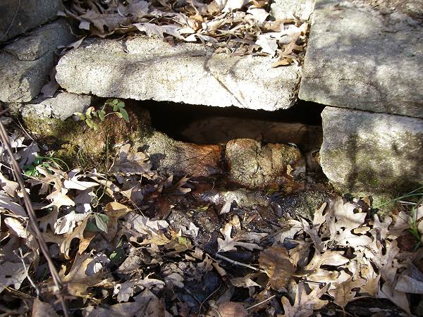
17 Deciduous Holly Tree Soon, Roy diverted off the road and we started walking down the other side of the hill through some thick woods maneuvering through brush and the occasional fallen dead tree. Roy said we were going to an old home site to see the “root cellar.” I don’t know how Roy found it but he did, located not too far from the Little Saline Creek which we could see swiftly running a short distance further down the hill. Here are some photos of the root cellar (photos 18, 19 and 20):
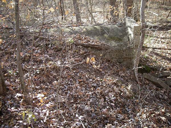
18 Root Cellar
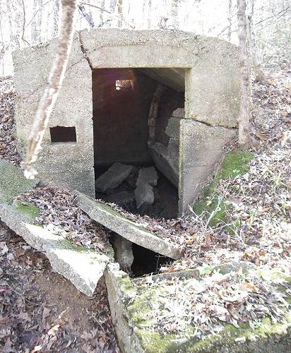
19 Root Cellar
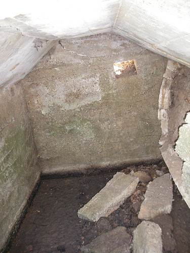
20 Root Cellar Roy said that when he was a boy a log cabin was still present nearby but no one was living in it. We were able to find the foundation stones of the cabin.
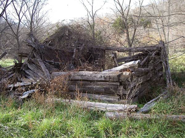
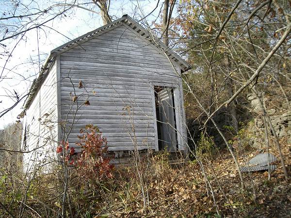
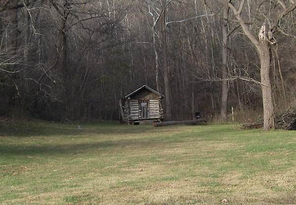
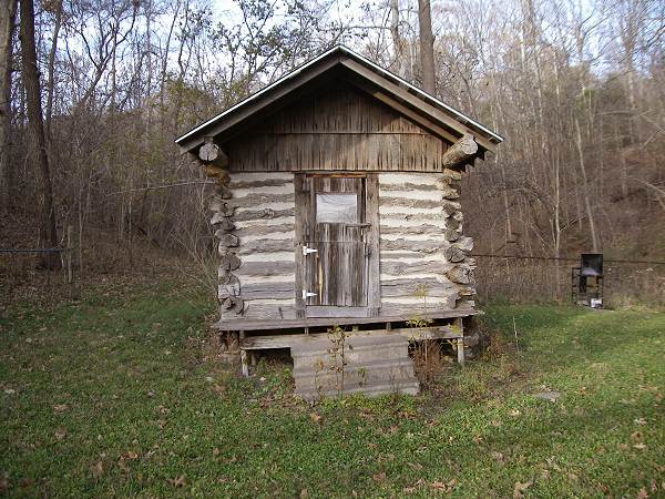
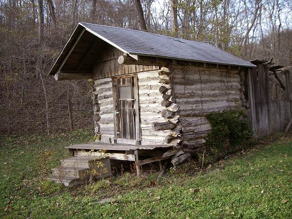
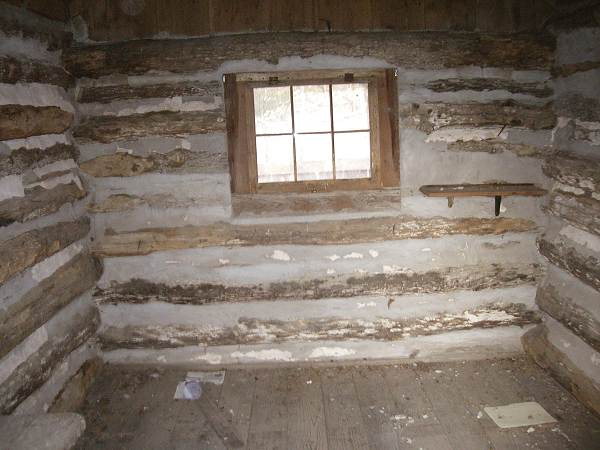
Roy said that there were about four or five old log cabins on the farm when he was a boy. Three of them housed employees of J.R. Wells. One of the old log cabins is still present although in a state of falling down. It is located near the old barn down in the river valley not far from Highway 17 (photo 21).
21 Old Log Cabin After looking over the root cellar we then climbed back up the hill to the ridge road. Soon Roy once again diverted from the road as we headed up to the peak of the hill. Roy walked around the area for several minutes and then found in the underbrush for what he was searching. It was a circle of large moss covered rocks about twenty feet in diameter surrounding a central excavation filled with leaves and brush. Roy told me they had been there ever since he could remember dating back to the 1930’s when he first found them. Here are some photos of the rock circle which, because of all the brush, really does not reveal adequately the rather symmetrical circle the rocks created (photos 22, 23 and 24):
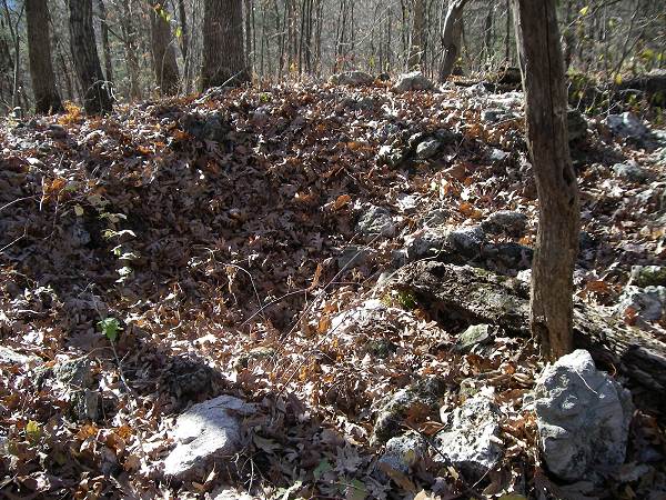
22 Rock Circle
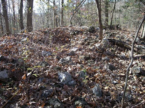
23 Rock Circle
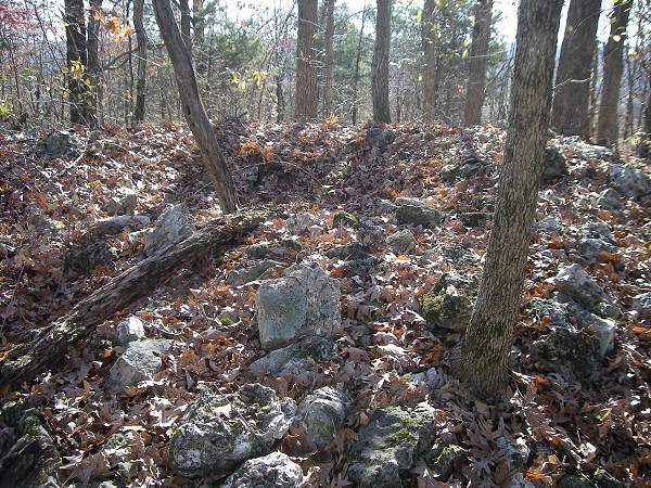
24 Rock Circle Roy told me he thought the rocks were put there by Indians. I suspect he is correct since they obviously have been there a long time and the circular pattern could not have been created naturally. Later, I called Ellis Bray of Eldon, who is our consultant regarding our county’s earliest inhabitants, and he told me probably what we saw was an Indian burial site called a “Cairn.” Ellis is going to return with me to this grouping of rocks after deer season at which time I will report back what information he can tell us about it. I do believe that this circle of rocks is an old Cairn after reading a narrative by Gerard Fowke about Indian Cairns found in Miller County as well as elsewhere in the Ozarks. You can read Gerard’s report yourself.by clicking on the link.
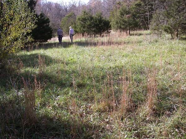
Retracing our steps Roy led me back to the ridge road going west where we came upon a colorful savanna (photo 25).
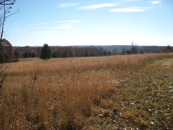
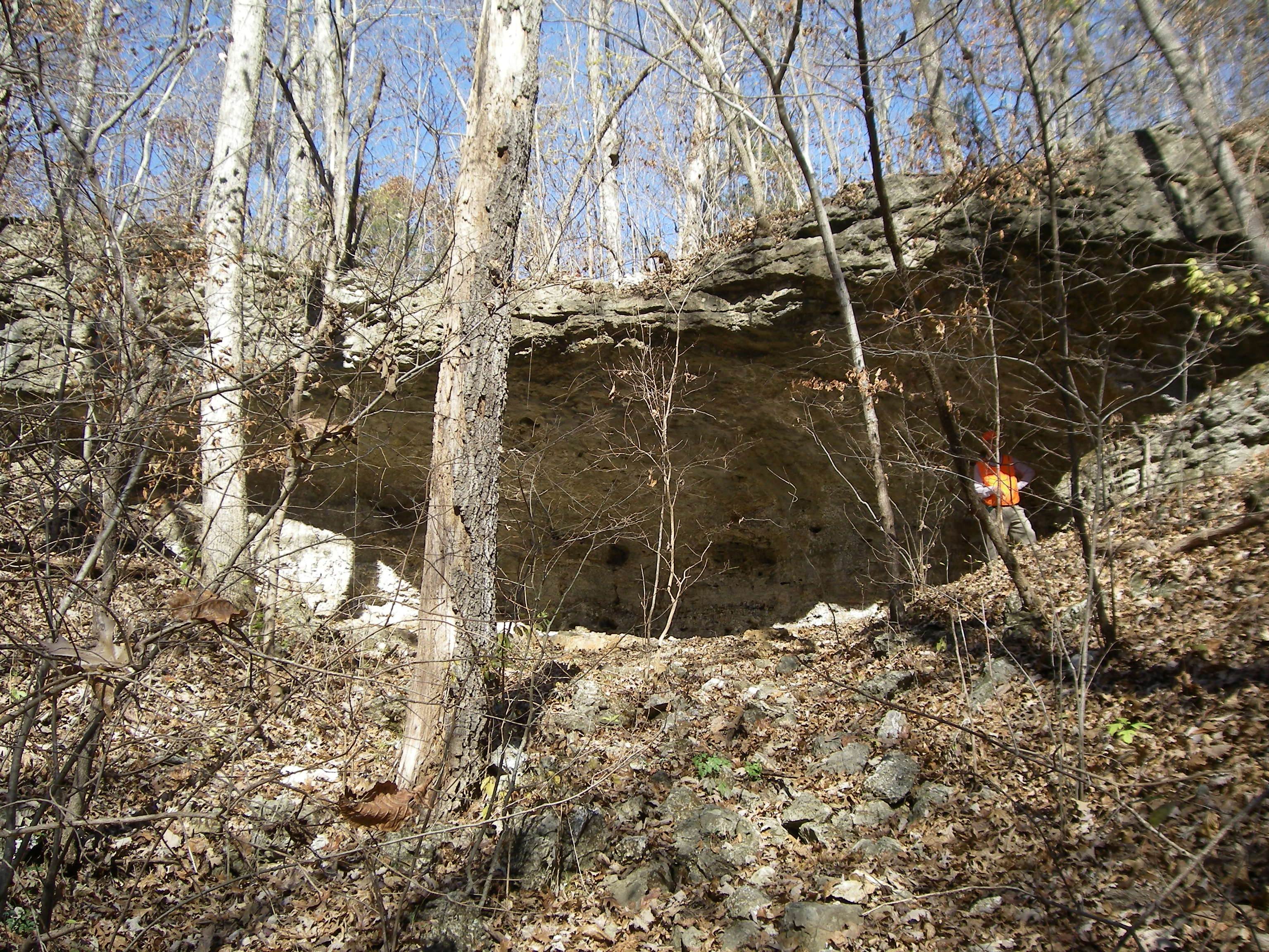
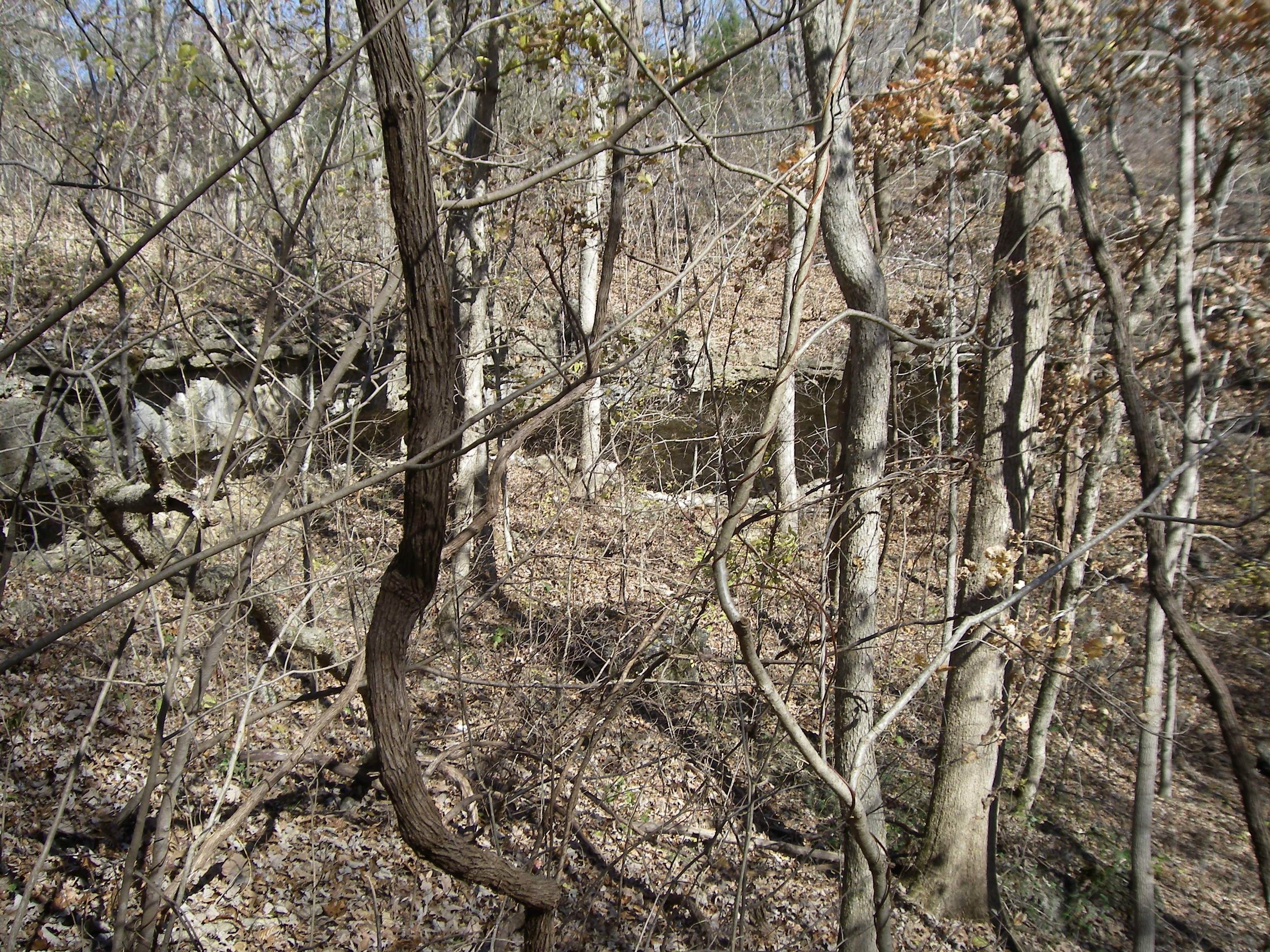
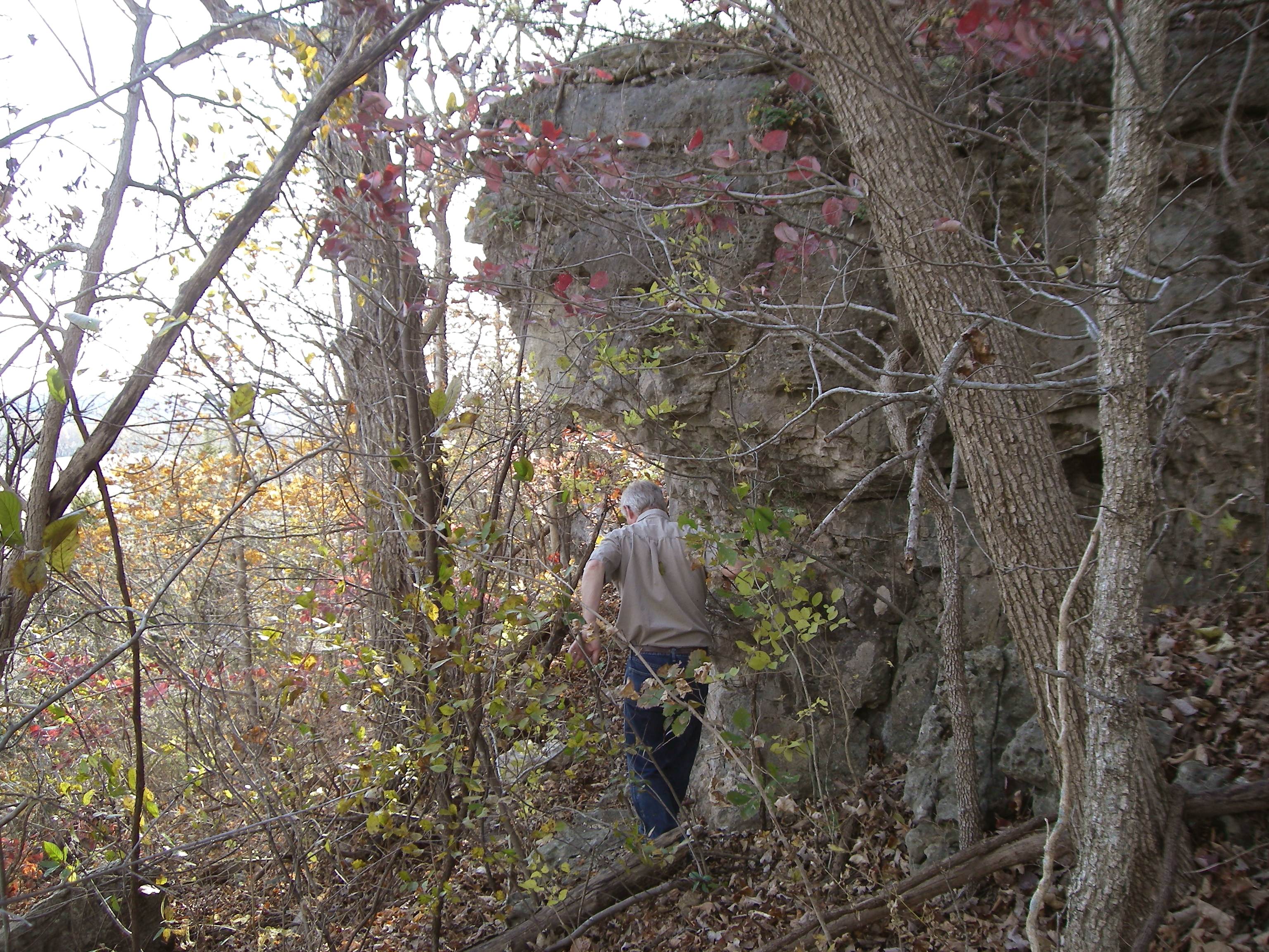
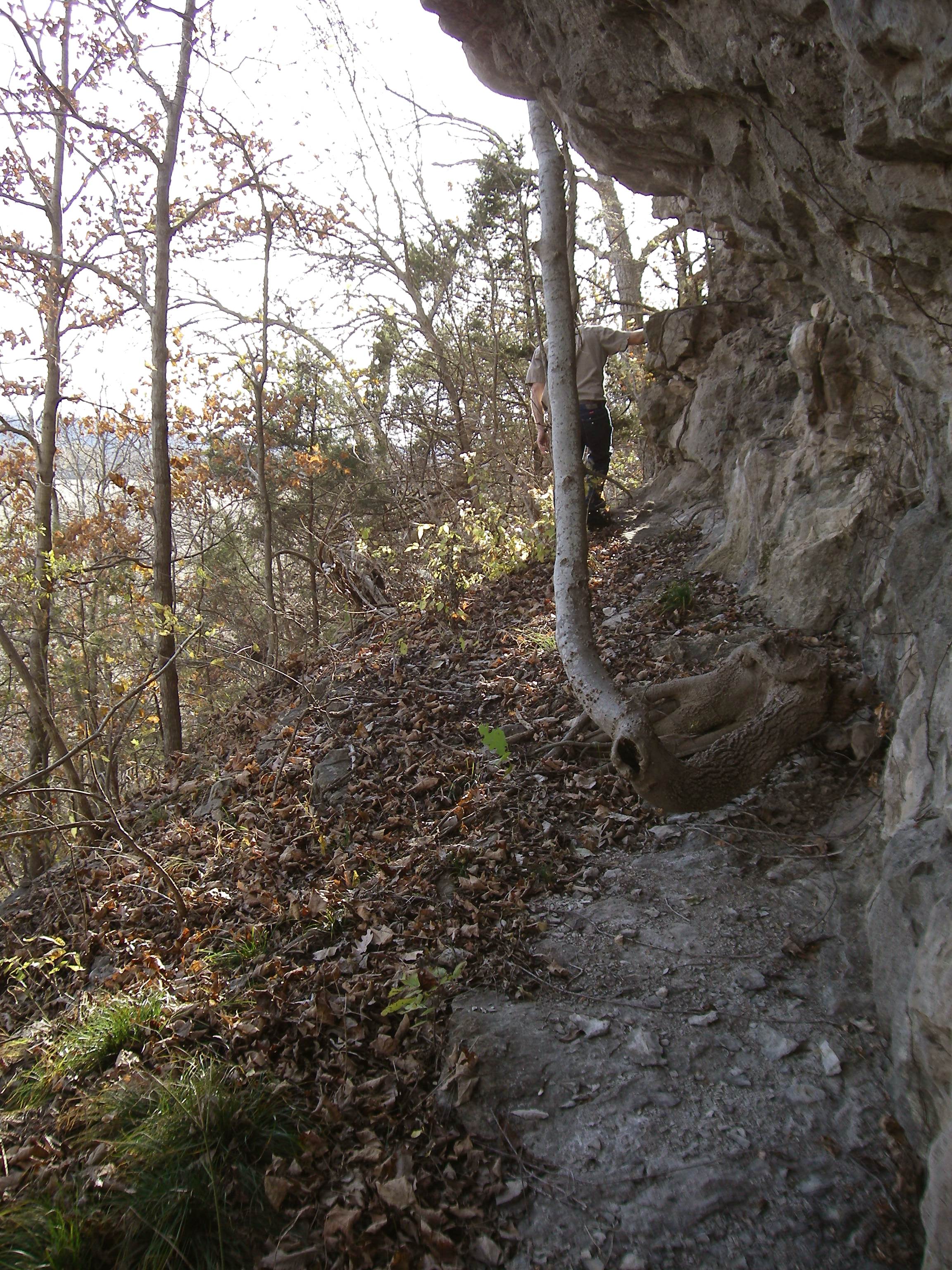
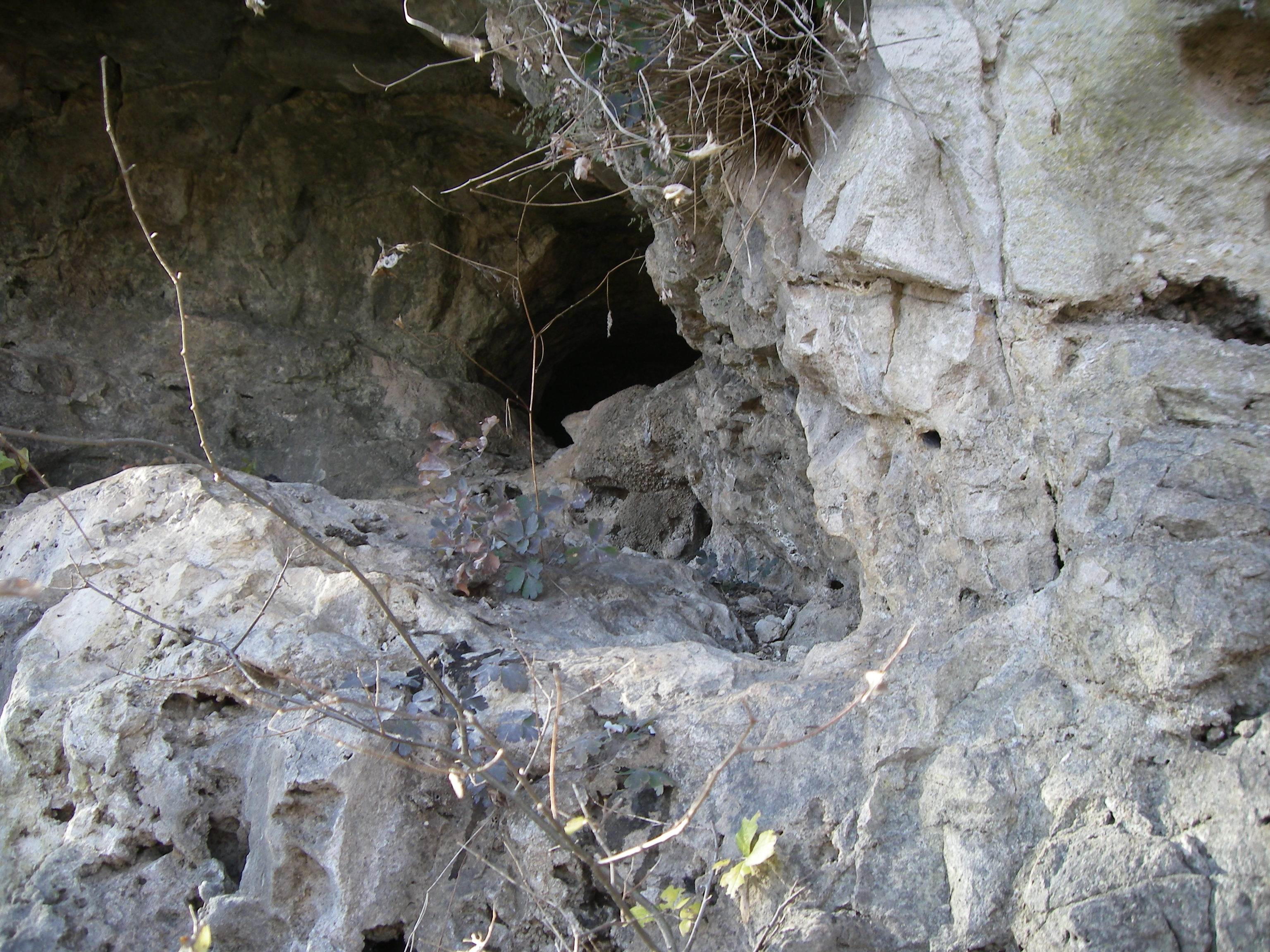
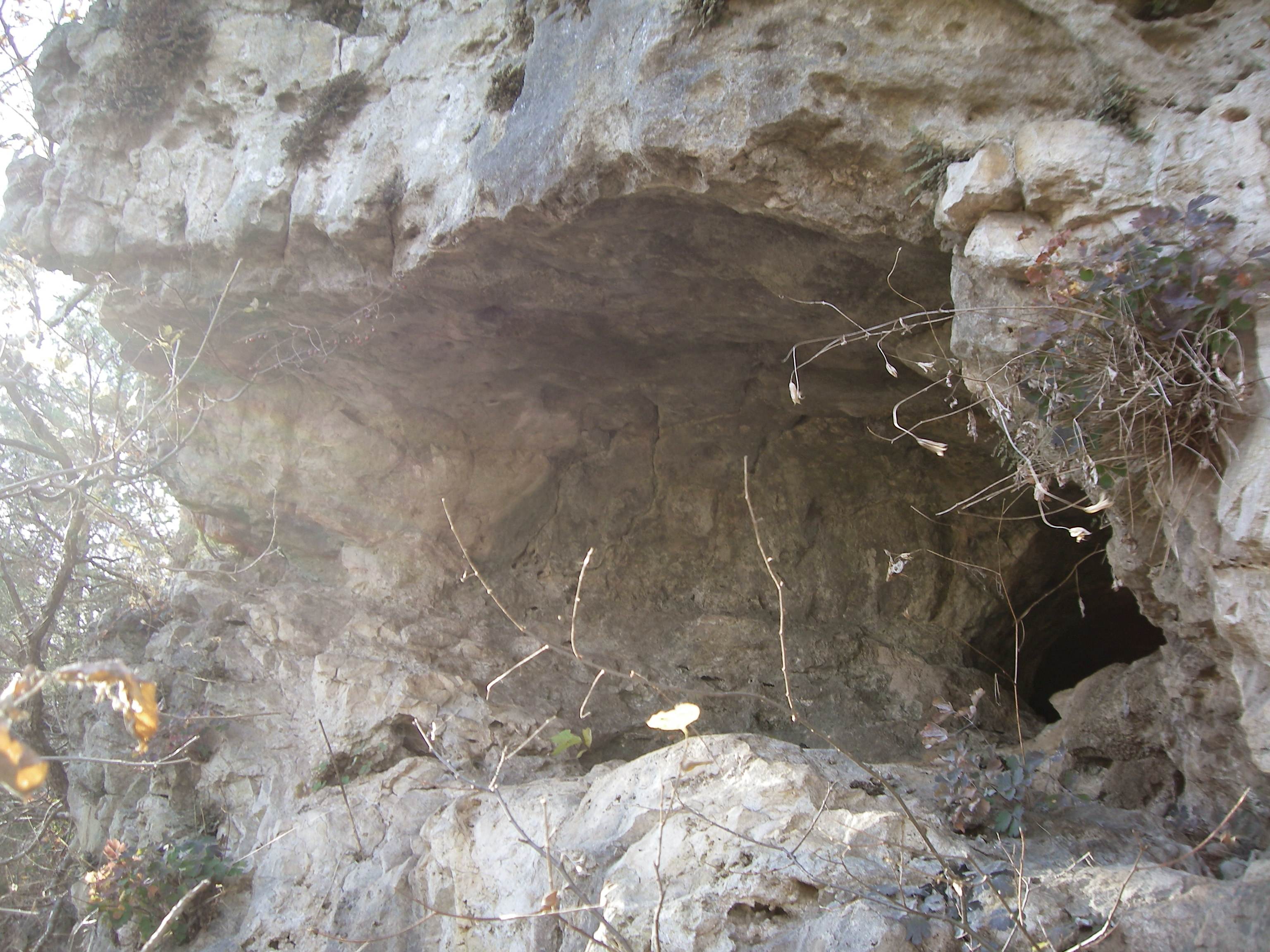
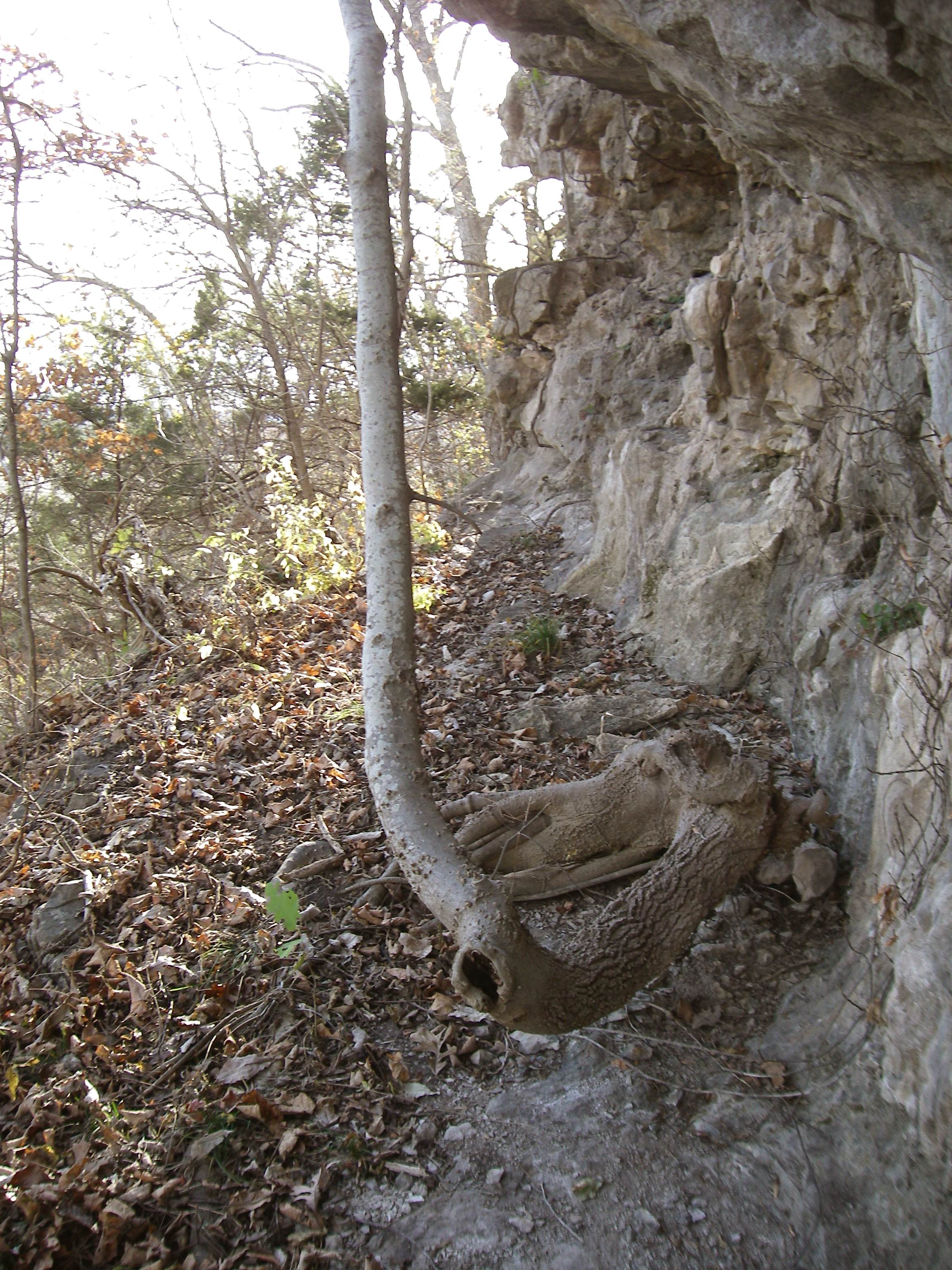
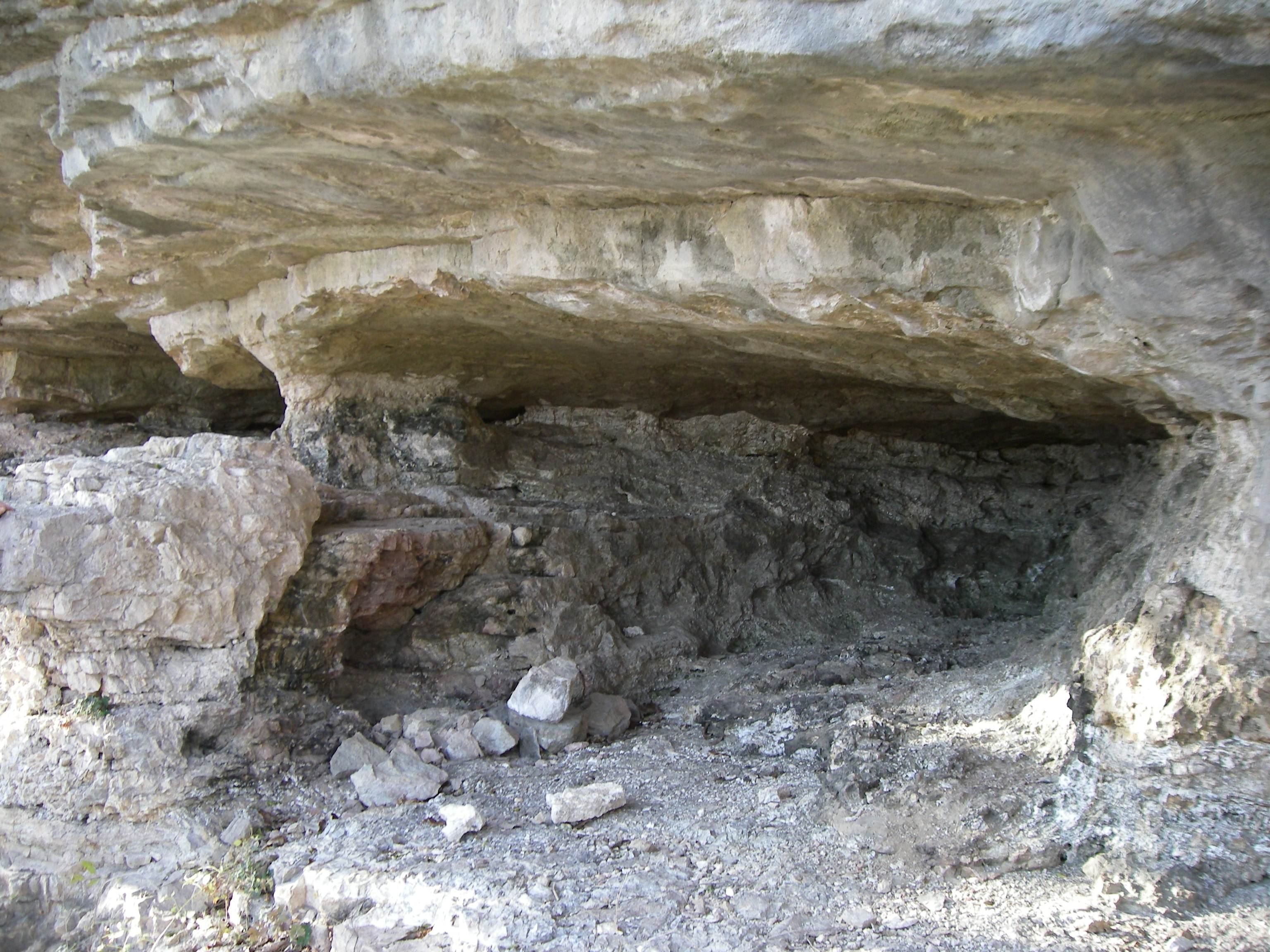
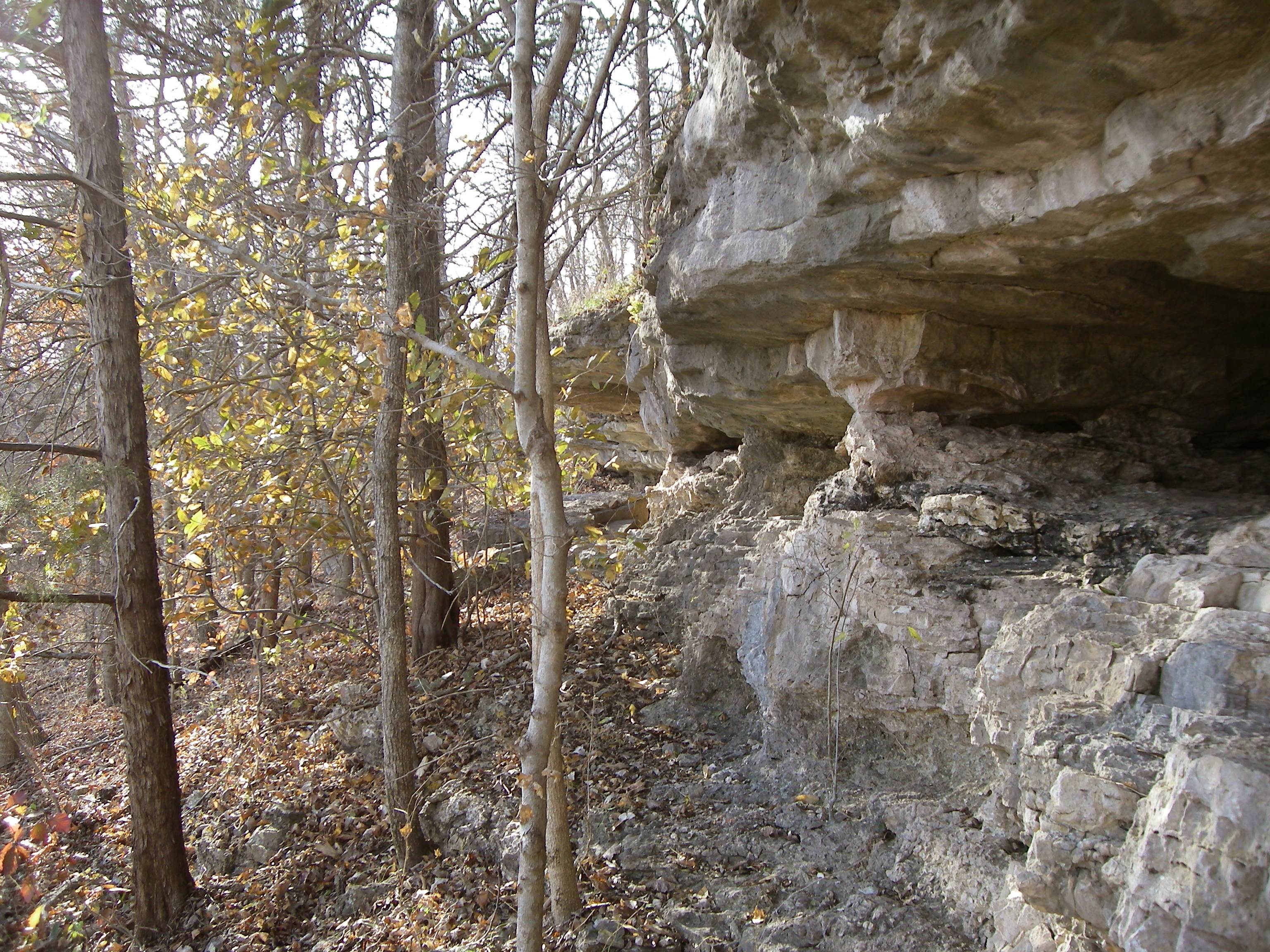
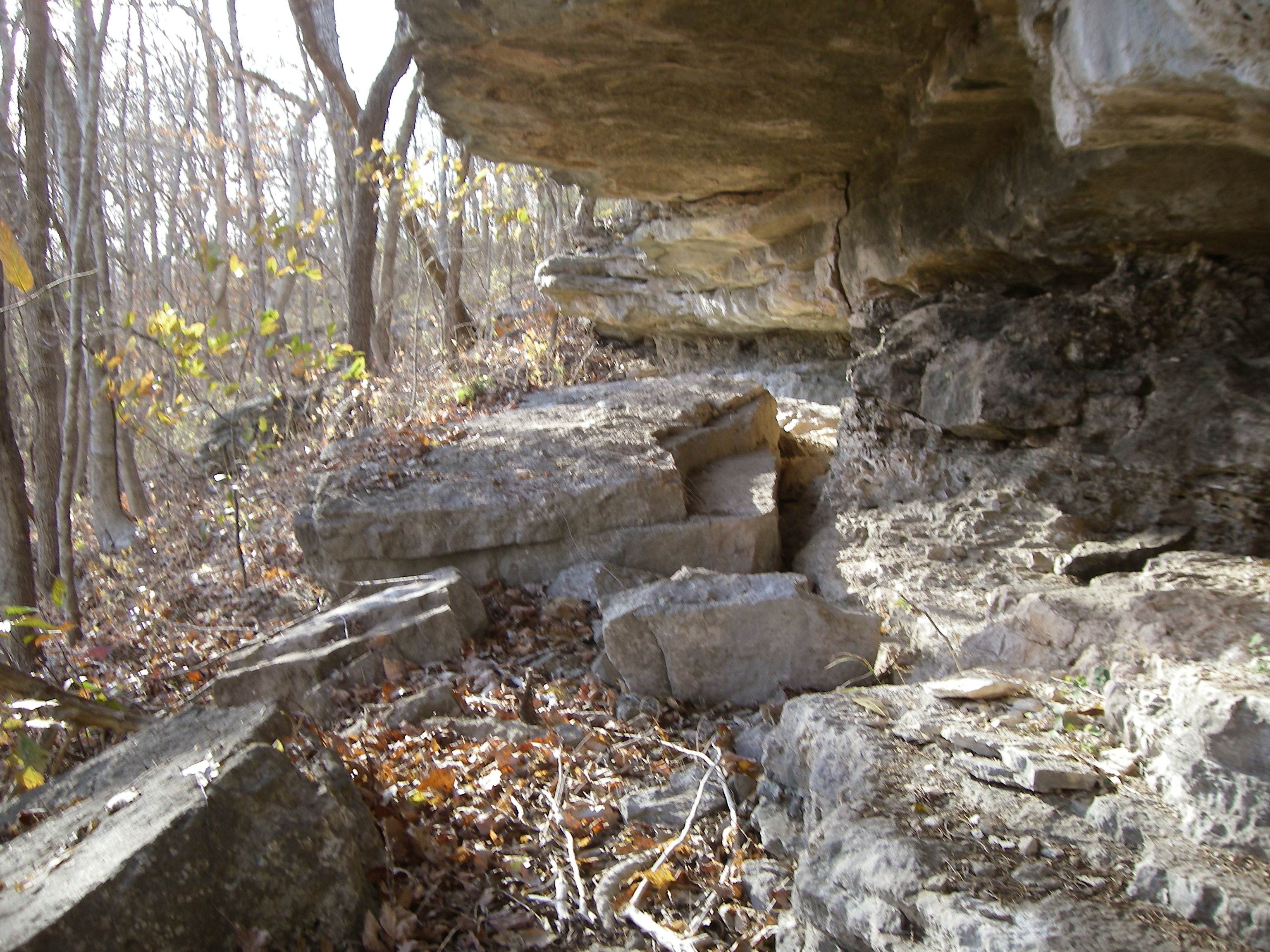
25 Scenic Bald Walking then across this area to the south we came to the beginning of a steep descent eventually which extended down to the Osage River valley. This was not an easy walk down through the cliffs and overhangs, some having small caves. Here is a collage of photos of this treacherous terrain for a walk (photos 26 - 37):
Click on any of the thumbnails to view a larger image.
Note: Once you click on an image below, a new window will open. It would be best to maximize this new window by clicking on the middle box in the upper right-hand corner of the window. When you move your cursor over the image in this new window, it will change to a magnifying glass. Once this occurs, click on the image and it will show in a larger format for easier viewing.
Sumac and buck brush were present here and there (photos 38 and 39).
38 Sumac
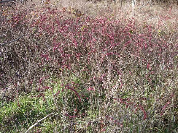
39 Buck Brush Upon reaching the valley where is located the original Wells home and barns we saw an eagle’s nest high in a tree (photo 40).
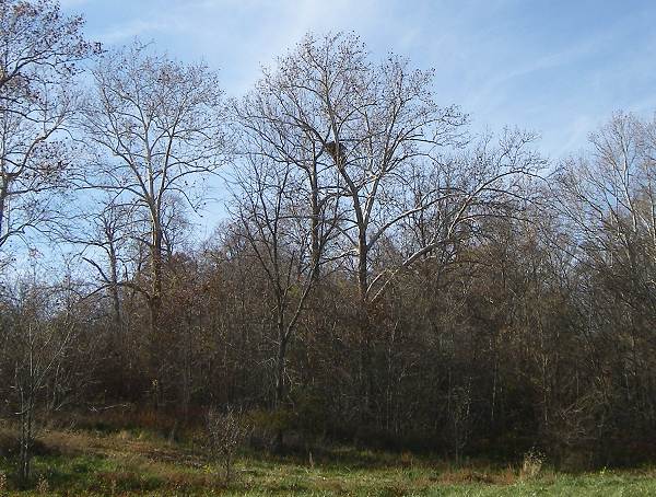
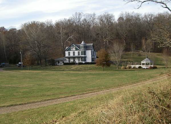
40 Eagle Nest We then approached the Well’s home (photo 41).
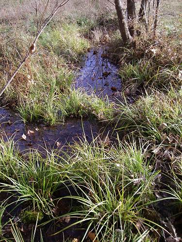
41 Wells Home Going behind the home we ascended the steep hill to locate the old spring on top of the hill which once supplied the home with running water based on an ingenious use of gravity. The old spring is unusual in that it is located on top of the hill rather down in the valley. On approaching the spring we came upon a marshy area covered with a lush growth of grass and weeds (photo 42).
42 Spring Fed Hill Top Present owner of the Wells farm, Glen Anderson, accompanied us to the spring. Here is a photo of the spring protected by a concrete shelter built many years ago (photo 43):
43 Spring From the spring one can still see an old pipe leading out which goes part way down the hill to an old cistern which was big enough to hold a large quantity of water (photo 44).
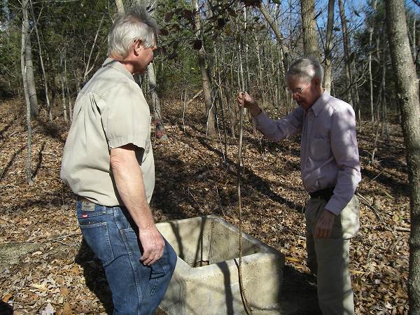
44 Glen Anderson and Roy Sone examining Cistern The cistern was above the home so that gravity took the place of a water pump bringing water down to the three story home where it was used for sinks and even toilets. This system was in place long before electricity was available.
However, drinking water for the home was provided by another spring located close to Highway 17 where a concrete spring house is located. This spring is still active today and these photos show the water running down a little creek out of the spring house (photos 45 and 46).
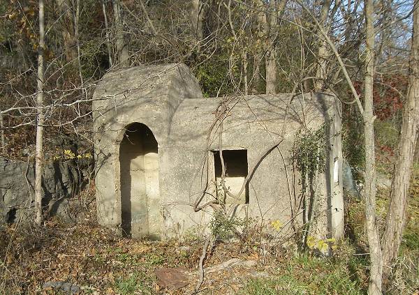
45 Spring House
46 Spring runoff from Concrete House Roy told me that the drinking water from this spring was manually carried to the home daily in a bucket. A smoke house which has been present as long as Roy can remember is located behind the spring (photo 47).
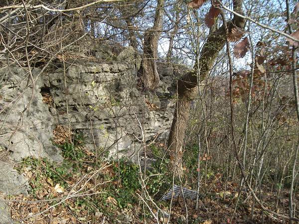
47 Smoke House The spring house is located under some bluffs very close to Highway 17 (photo 48).
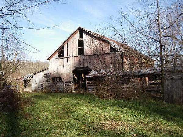
48 Spring House Bluff The large valley where the Wells home is located contains the old barn and an old hand pump (photos 49 and 50).
49 Old Barn
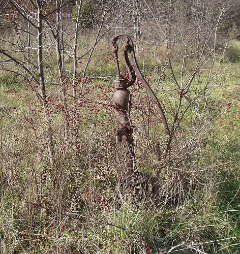
50 Old Pump What is left of the original cabin where Charles Wells lived is located near the Wells home (photos 51 - 54).
51 Charles Wells Cabin
52 Charles Wells Cabin
53 Charles Wells Cabin
54 Charles Wells Cabin If you look at the photo of the original log home of Charles you will see this smaller part of the home on the right side of the photo (see photo 06 above). The present location of the home near the large Wells home, is not the original site which was closer to the highway and the barn. Why it was moved no one is sure now. Roy said it already had been moved before he can remember. Also, no one is sure what happened to the large two room section of the home which is evident in the original photo but not present now.
Glen Anderson is the present owner of the Wells’ home. He is rehabilitating it with the goal of maintaining its original style and appearance. We are certainly appreciative of his hospitality while we were visiting the home site, out buildings and springs.
This week will be the last to include the installments from the book, Ozark Superstitions by Vance Randolph (photo 55).
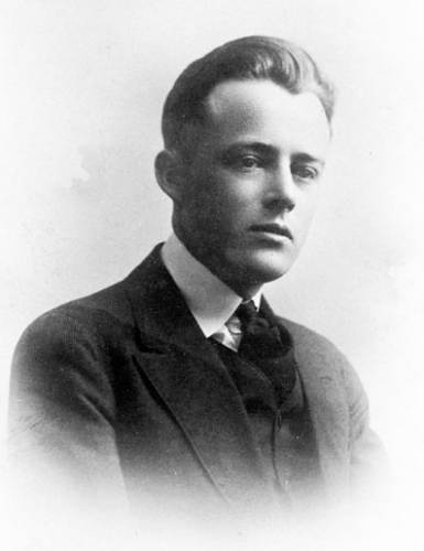
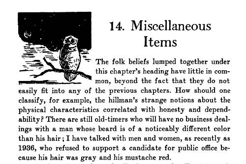
55 Vance Randolph I had known of some of the superstitions growing up as a boy in Tuscumbia since both my parents were from rural areas and had heard the old folks talk about them. But by my time the superstitions were more of a habit without much thought or even belief if someone was questioned about them. These days though one doesn’t see much of that anymore. This week’s chapter by Vance is titled “Miscellaneous Items” and includes some really weird anecdotes of beliefs and habits from the past of those who lived in the southern half of Missouri and northern Arkansas (photo 55a).
55a Ozark Superstitions - Miscellaneous Items
Click image to read the entire chapter in PDF formatRefer back to the Progress Notes of August 30 to read Vince’s biography.
Tuscumbia native Alan Sullivan is a mechanical engineer who has been employed by AmerenUE at Lake Ozark since 1977 (photo 56).

56 Alan Sullivan Through the years Alan has been instrumental in arranging for various historical items related to the construction of Bagnell Dam to be donated to our museum. The most recent occasion was in February of this year when Alan donated two original historical electrical panels from the power plant at the Dam (photo 57).
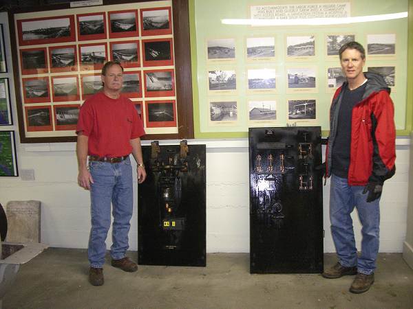
57 Randy Stafford and Alan Sullivan If you want to read more about this donation refer to this previous Progress Notes.
You may not know that Alan also is a historian who has written about Bagnell Dam and the surrounding area, most recently as a contributing author to a Lake area magazine, Lake Profile. The magazine is sold at various retail outlets in the Lake area, the most recent edition being the November/December one (photo 58).

58 Lake Profile Magazine Cover
Click image for larger viewThis edition includes an article written by Alan about the early history of the Lake of the Ozarks and how this area became the number one tourist destination in Missouri. You can view the online edition of the magazine by clicking on the link.
For those readers who live away from the area I will copy the article here:
The Power of a Dream
Alan Sullivan
L.O. Profile Nov/Dec 2010 p. 29
As with most great things, it all began with a dream. The year was 1912 and the “someone” was Ralph W. Street, a Kansas City attorney. Street dreamed of building a dam and a hydroelectric power plant on the Osage River. Years passed, plans were made, plans were changed, plans were canceled. Money was promised…promised money was canceled. Debt was overwhelming, foreclosure was threatened, bankruptcy loomed. But Ralph Street had such a clear vision of his dream that he would not be discouraged by adversity and circumstances. In 1929, after much perseverance…and with the help of Union Electric Company…construction began on the” Great Osage River Dam.” Barely two years and a half million cubic yards of concrete later, the great turbines turned, and Ralph Street’s dream came to life (photo 59).
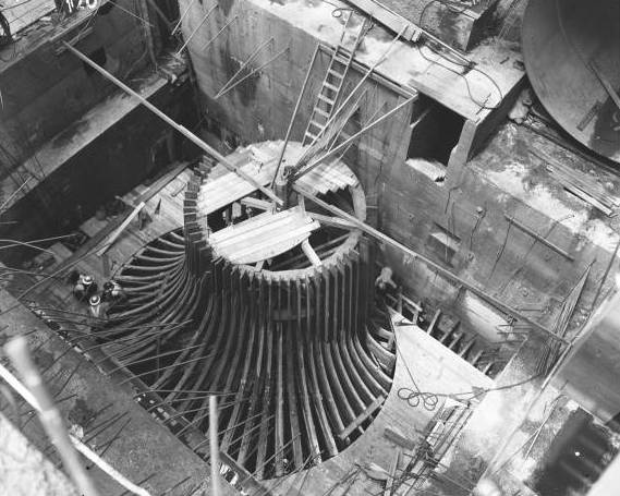
59 Turbine But no one, not even the biggest dreamer, had any idea of what they had really created. For what was to come was far beyond the wildest imagination of anyone. Here is the rest of the story.
As electrical power was produced from the new generators at Bagnell Dam, America was fast becoming reliant on electricity. Electricity brought about a new wave of post Depression affluence to America. As the nation began to grow and prosper, people began to think more about travel…and vacations.
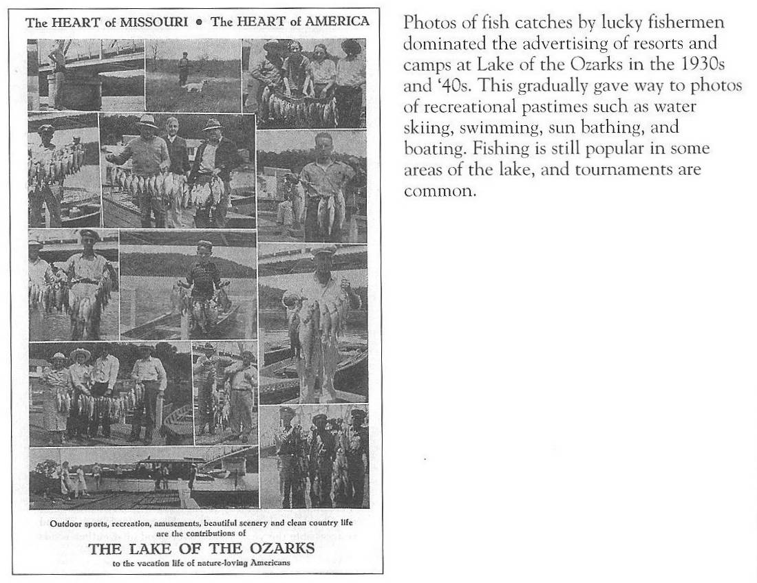
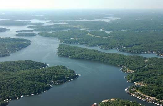
Although Bagnell Dam was conceived and built as a means of generating electricity, another resource was created…a resource that, in time, would become a major economic factor in the state of Missouri. To service the huge hydro turbines at the dam it would require water. Lots of it. In addition to producing electricity, the dam was designed to hold back more than a billion gallons of water. This formed a lake 120 miles long with more than 90 square miles of water surface. The Lake of the Ozarks was born (photo 60).
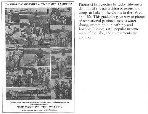
60 Lake of the Ozarks Aerial View As time for recreation became more easily available, tourists flocked to the Lake, mostly for fishing and hunting. Lakefront cabins sprang up all around, with a “mom and pop’ resort here and there. Fish populations exploded, and the Lake of the Ozarks quickly became known as one of the prime fishing spots in the U.S. Because most of the upland areas were undeveloped (the land was viewed as worthless because it was not good farm ground), lakefront duck hunting was also popular. Maps were created to show hunters the location of duck blinds. A vacation paradise was beginning to catch on (photo 61).
61 Fishing Camps - From Dwight Weaver
Click image for larger view“My resort was built in 1953 by Wilbur Duenke,” Bruce Thompson, owner of Mallard Point Resort, tells us. “His brother Burton would sometimes come and help with the construction. In the evenings, Wilbur and Burton would sit out on the lakefront, have a drink and talk about what the Lake would someday become.”
Burton Duenke had a dream of his own, and he soon purchased 3,800 acres down a gravel road on Turkey Bend…the site where he developed the Tan-Tar-A Resort and Estates. Bruce jokes, “I told Burton that I’m going to put a sign on my back deck that reads, “The Birthplace of Tan-Tar-A” (photo 62).

62 Tan Tar A The years following World War II brought another wave of prosperity to America, and to the Lake area. Powerboats with shiny wood hulls made by Chris Craft found their way to the water. Of course, most Americans couldn’t afford a powerboat, so speedboat rides were a real treat for vacationing families. Casino Pier and Loc Wood Dock near the dam were the prime spots to buy a boat ride in the 1940’s, ‘50’s and ‘60’s.
Note: see this Progress Notes narrative for photos of the early Lake boats.
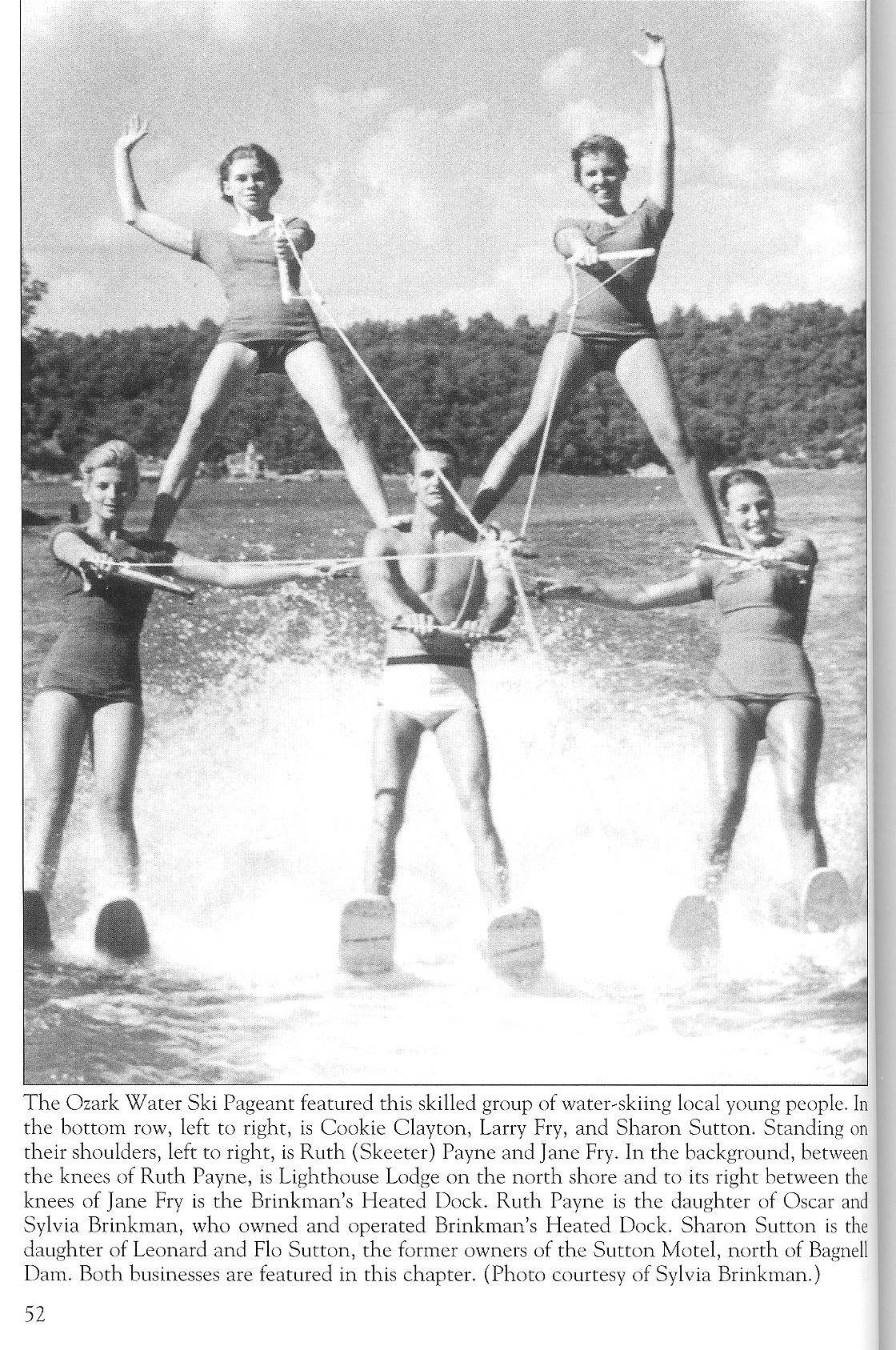
As more residents and visitors were able to purchase their own boats, the popularity of speedboat rides faded. However, this opened the Lake to a popular new sport. Water-skiing was catching on, and the huge Lake of the Ozarks was the perfect place. As with most new things, some intrepid souls soon become bored, and boldly learned new tricks, such as skiing on one ski instead of two, jumping wakes and skiing backward. Really daring skiers learned to jump a homemade ramp, or even ski barefoot.
It didn’t take long before the entertainment value of such antics was recognized, and the Ozark Water Ski Thrill Show was born just off the strip in Lake Ozark. This show began in the 1950’s and ran for more than 20 years (photo 63).
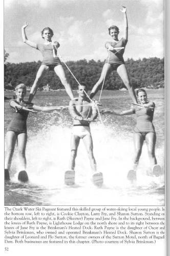
63 Ozark Water Ski Pageant - From Dwight Weaver
Click image for larger viewFor a few years, the Lake hosted two ski shows. In addition to the ski show in Lake Ozark, the Fort Osage Water Show began in Osage Beach in the 1980’s. Lake resident Todd Shockley (now an elementary school principal in Camdenton) recalls, “We used to do a ramp jump act in the Water Show with five skier. We called it the “Smorgasbord.” Three of us would jump the ramp, the center guy did a front flip, the two outside guys did helicopters (a 360 degree spin) and the two guys on the water crisscrossed underneath us while we were in the air.”
Todd recalls that one night, he was one of the crisscross pair and he forgot to pull in on his rope. As the other skier sped toward him in the dark (it was a night show), the two collided at high speed. Both went to the hospital and were out of action for the rest of the summer. Water ski stunts like this were very entertaining, but also dangerous.
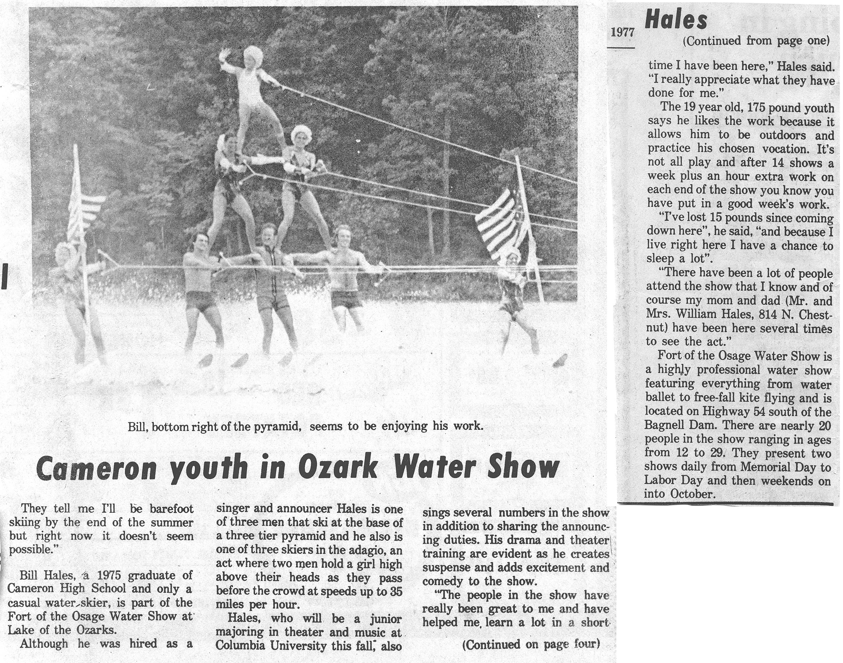
Note: David Statler, who uploads my Progress Notes for our website each week, informed me that his wife’s brother, Bill Hales, who grew up in Cameron, Missouri, also was part of the Fort Osage Water Show. His hometown newspaper, Cameron Citizen Observer, wrote an article about Bill’s part in the show. You can read the article here (photo 63a):
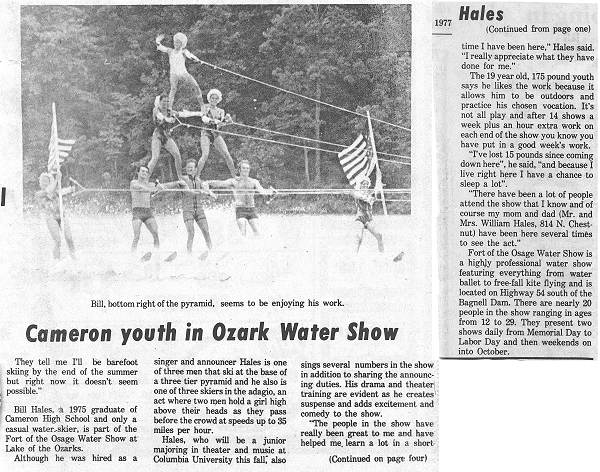
63a Bill Hales - Fort of the Osage Article - 1977
Click image for larger viewThe Bagnell Dam Strip has been a favorite cruise spot for teenagers and young adults since the 1960’s (photo 64).
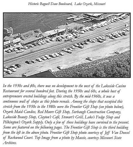
64 Bagnell Dam Strip - From Dwight Weaver
Click image for larger viewThe early years also brought live bands and nightly dance cruises on the Larry Don and Tom Sawyer excursion boats (photos 65 and 66).
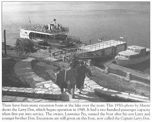
65 Larry Don - From Dwight Weaver
66 Tom Sawyer During the summers of the ‘60’s, ‘70’s, and ‘80’s, summer dance cruises were a nightly thing. Ticket sales were frenzied, as the two boats competed for the hundreds of customers on the Strip. In the springtime, the Larry Don was a popular attraction for high school senior trips as a local band, the Blue Knight, would play two dance cruises every night, seven nights a week.
In the early 1970’s, something new popped up on the Lake…on-the-water floating restaurants. One of the first was Frank Bachelier’s “The Barge,” built in 1972. His giant sign simply read “Hamburgers,” and was one of the first places on the Lake where customers could just drive their boat right up to the dock and eat.
Music shows off the water have also provided popular entertainment for residents and visitors since 1953, when Lee Mace began the Ozark Opry in the attic of the Casino Café (photo 67).
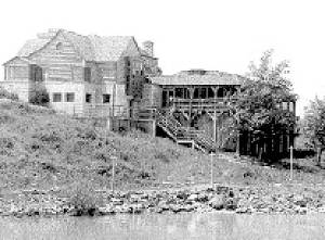
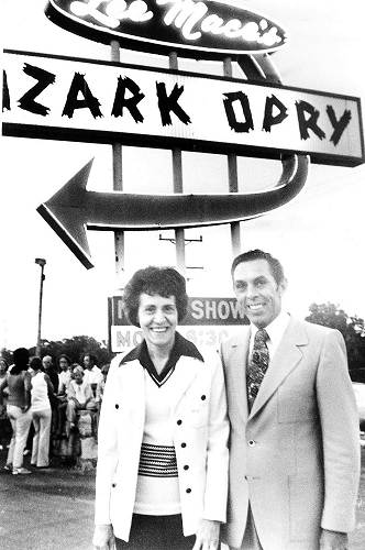
67 Early photo of Old Casino Café Later Lee and his wife Joyce moved the show to Osage Beach (photo 68).
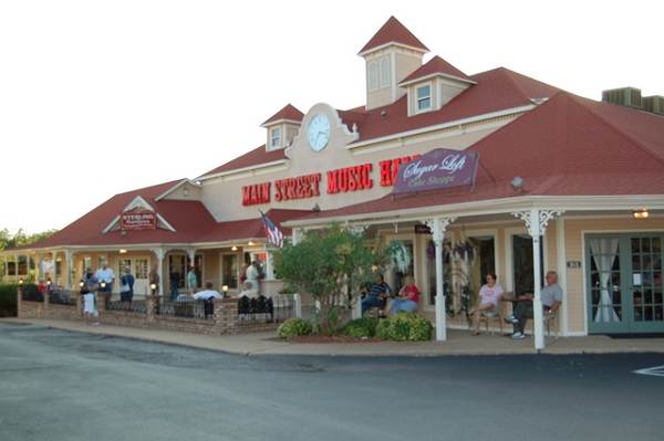
68 Lee and Joyce Mace under sign at Osage Beach Auditorium The Main Street Music Hall in Osage Beach is still thrilling audiences nightly with a traditional variety show, as well as a new show featuring ‘70’s music. For the holiday season, their ever popular Christmas show in November and December is a must-see (photo 69).
69 Main Street Music Hall From the fishing and hunting camps of the 1930’s, the Lake of the Ozarks has continued to grow and prosper as a vacation haven for both on and off water recreation. Millions of visitors have come to know it as simply “The Lake.” Tim Jacobson, Executive Director of the Lake of the Ozarks Convention and Visitors Bureau, and Jim Divincen, Executive Vice President of the Tri-County Lodging Association shared with us the top five reasons why visitors should come to the lake for vacation.
1. This is the only major lake in the southern Midwest where you can walk right out of your resort unit to the dock and hop into your boat.
2. The Lake abuts two major state parks, one of which is the largest in Missouri. The Lake of the Ozarks State Park has more than 17,000 acres of woodlands, trails, camping and boat launch facilities. Ha Ha Tonka State Park, at 3,700 acres and with some 15 miles of trails, is one of the most picturesque parks in the U.S., showcasing the ruins of the 100 year old Ha Ha Tonka castle, stable and water tower, as well as a breathtaking view of the Lake from the cliff top.
3. The state’s largest outlet mall is located at the heart of the lake area. The Osage Beach Premium Outlets contain 110 stores with hundreds of brand names, all at outlet prices.
4. The Lake of the Ozarks has become known as one of the Midwest’s premier golf destinations, featuring 16 beautifully manicured golf courses. Of those, 14 are public.
5. The last of the top reasons to come to the lake is that there just is simply so much to do. Here is just a sampling of some of the events and attractions: (photo 70).
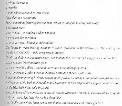
70 Lake of the Ozarks Activities
Click image for larger viewIt all began in 1912 with one man’s dream to build a dam to make electricity. Ralph Street had a dream so big that he did not let adversity, nay sayers or financial problems keep him from achieving his dream. His pioneer spirit, tenacity and perseverance have become a model for those who have come after him. The Power of the Dream…his dream…has grown to become our dream, and it is alive, well, and continues to grow and prosper to this very day. See you at the Lake!
Thanks Alan for this review of the history of the beginnings of the huge tourist industry created by Bagnell Dam and Lake of the Ozarks, a major economic event in the history Camden, Miller, Morgan, Benton, Henry and St. Clair Counties.
You can read more about the actual construction of Bagnell Dam at this location on our website:
That’s all for this week.
 Joe Pryor
Previous article links are in a dropdown menu at the top of all of the pages.
|